

Well Creek Weir, Sluice or Spillway, Salters Lode
Page good for smart-phones. On PCs/Laptops it may look too large. To reduce press "Ctrl" & "minus" or click "View" then "Zoom out"
Created Mar 2013, last edited: 17/03/26, 21:03
Created Mar 2013, last edited: 17/03/26, 21:03
Introduction
A little way south of the Old Bedford Sluice at the northern end of the Counterdrain/Old Bedford River (CD/OBR) at Salters Lode, there is a cutting though part of the western bank of the river that some boaters refer to as a boat turning place but in fact leads to a flood relief spillway known as the Well Creek Weir.The name seems to me to be rather inappropriate as its suggests there is a weir on the Well Creek itself, which there isn't. But this is the fens, where names so often cause confusion to strangers.
| If visted before, please "refresh" page to see latest version. |
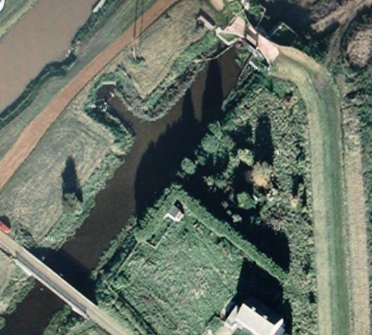
Google satellite view.
Well Creek centre left to top centre.
Old Bedford River below, looking black. Weir is just above centre between the indents on the two rivers.
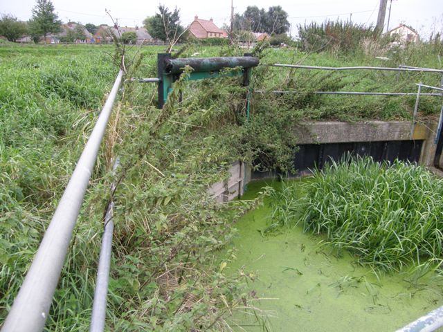
Above, inlet gate from OBR
The spillway and reasons for it
The CD/OBR drains waters from Colne and Somersham in the south and the fen areas west of the washes, all part of the Middle Level. Water should be discharged by gravity via the Old Bedford Sluice/Lock into the Great Ouse Tidal River, thence to sea .... but ....If the sluice is tide locked or cannot be operated for other reasons (e.g. siltation) and the CD/OBR level reaches 1.15m AOD at Welches Dam (WD), Welney Sluice Gate closes and the WD pumping station starts up (both automatically) transferring water from the CD/OBR into the River Delph.
If the level of the CD/OBR at Salters Lode still rises and reaches 1.65m AOD despite the above operations, water flows over the 3m wide weir into Well Creek, part of the Middle Level system, and eventually to sea via the MLC pumping station at St.Germans.
In 1996 the NRA refered to this simply as Well Creek Weir. In 2002, an EA report called it Well Creek Weir & Sluice.
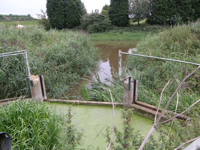
The weir, looking down to OBR.
The grooves in the concrete enable dam-boards to be fitted to block the weir.
The cut through the bank has been used to turn boats around.
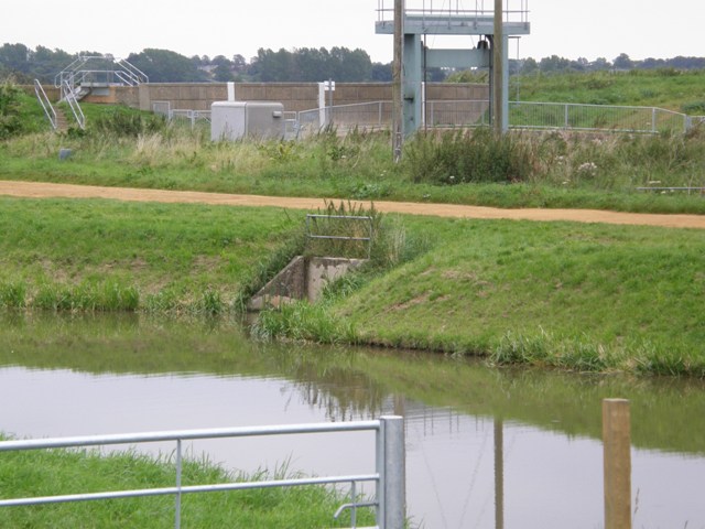
Weir outlet into Well Creek.
with lift gate on OB lock on far side
In Apr 2008, the Cranbrook/Counter Drain Flood Risk Management Strategy report regarding what to do about the ageing Welches Dam PS and Old Bedford Sluice, says that one option considered was to decommission Welches Dam PS and improve use of drainage via Well Creek Weir, but that but was discounted because poor hydraulic performance would not achieve the indicative flood risk standard.
Subsequently, WD PS was re-furbished in 2010-11.
| Related pages on this website |
| Salters's Lode Sluice |
| Old Bedford Sluice |
| Welches Dam |
| Welney Gate |
| Related pages on external websites |
| Well Creek Trust |
| Middle Level Commissioners |
Acknowledgements
Text and photos except where noted © Peter Cox, 2010-26The details of James Smart's life are from "Fen Speed Skating - an illustrated history" by John Slater and Allan Bunch, published by Cambridgeshire Libraries in 2000,
If you think there are any errors or ommissions on this page or would like to comment, please e-mail Peter and your response will be added.