
Ouse/100 Foot Washes Management 1920-89
Page good for smart-phones. On PCs/Laptops it may look too large. To reduce press "Ctrl" & "minus" or click "View" then "Zoom out"
Created 02/07/2013, last edited: 14/03/26, 10:03
Created 02/07/2013, last edited: 14/03/26, 10:03
Introduction
From its foundation in 1663, the Bedford Level Corporation (BLC) controlled (at least nominally) drainage of a vast area of lowland fens, not just the Ouse system, but that of the Nene and other rivers too.It was nearly always short of funds due to restrictions in rating (taxing) landowners (a problem inherited from the original Company of Adventurers); was often unable to deal with local drainage problems; and some of its works restricted navigation. As a result many other bodies were set up to deal with local or specific needs; and the North Level and the Middle Level divisions of the Great Level became totally independent.
During the second half of the 19th C there were many calls for a unified approach within each river system, but proposals failed for want of consensus on fair funding. Basically, those in upland areas did not to want to contribute to lowland drainage, and those in lowland areas thought it unjust to have to pay to drain "other peoples water" i.e. from upland areas, to the sea.
In the early years of the 20th C it was realised that this rather shambolic state could not continue any longer. According to Summers (Great Level, p215) there were 83 drainage authorities operating in the Great Ouse area plus 12 bodies dealing with the main chanels and outfall. Government acted, creating a new authority to take overall command of the river from 1920.
| If visted before, please "refresh" page to see latest version. |
Ouse Drainage Board, 1920-1930
This was established under the Land Drainage Act 1918 by the Land Drainage (Ouse) Provisional Order, 1920, later confirmed by Parliament.It made the whole length of the River (Great) Ouse and its tributaries and land either side to a certain extent (but not the whole watershed) one drainage district broken down into areas and sub-areas but all under the control of a single main board administered from offices at 90, Hills Road, Cambridge. (They may also have retained the BLC's old 'Fen Office' in Ely.)
The Middle and South Levels and local IDBs would continue to manage their own areas as before, but they would now need permission from the new board for new works or alterations to existing structures.
The part of the district above Earith was referred to as "uplands", and from Earith to the sea as "lowlands". In the lowlands, the new Board took over the responsibilities, assets and liabilities of the Bedford Level Corporation, the Eau Brink Commissioners, the Ouse Banks Commissioners, the Lower Ouse Drainage Board, the Ouse Outfall Board and the Denver Sluice Commissioners.
In an attempt to make drainage rates fairer, instead of charging just the lowlands as customary, they were also levied on parts of the uplands, in areas that were below a contour line which was supposed to indicate a level of "8 ft above the highest known flood level" measured, according to an unidentified source, "at Bedford Bridge". I have not been able to verify this.
An interesting provision of the 1920 order was in respect of the operation of Seven Holes Sluice on the Old Bedford River at Earith. The gates "were not to be fully drawn" until the level of Bedford Ouse had reached "13.9 feet above Ordnance Datum" from April to October, and "two feet less" from November to March; the higher summer level being intended to reduce summer flooding in the Washes by raising the upstream river level.
The 1920 figures equate to 3.84m and 3.23m, a little above the current 3.77m and 3.17m levels which have been used for Earith Sluice for many years. If you do your own conversions and reach different figures, please see my water levels page for a possible explanation.
The aims of the 1920 order were laudable, but it still proved unpopular ........
The Land Drainage Act, 1930
Why it came about
The basis of land drainage funding since the Statute of Sewers in 1531 was "no benefit, no rates". No subseqent law had dared change that, although the 1920 Ouse order above did try a little modification.In April 1925 the Ministry of Agriculture (which had responsibilty for land drainage) recognised that the 1920 order needed revision and set up a 4-man Commission to investigate problems, particularly funding. Their report in Dec 1925 included these main recommendations for the Great Ouse river system:
- The 1920 order be scrapped and a new district formed for the whole watershed.
- A number of major works in the lower reaches and outfall.
- The Government to make a grant of half the costs
- Abandon, at least partially, the age-old rule whereby upland areas do not contribute to lowland drainage.
- Drainage rates to be levied on "upland" areas below 20 feet AOD (un-defined)
the Land Drainage Act 1930.
The two principal points were: to have one authority in each catchment area to deal with the main channel and banks and working in collaboration with the IDBs for dealing with the minor drains; and radical alteration of the way rates were levied.Details to follow .......
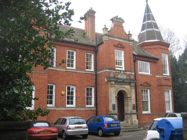
"Elmhurst" Brooklands Ave, Cambridge, in 2008
photo by Mr Ignavy on the Geograph website
The River Great Ouse Catchment Board, 1930-1952
This was established by an order under the 1930 Act. The new Board's main office was initially that of the previous Board, 90 Hills Road, Cambridge, but in the mid/late 1930s they moved to Elmhurst, a huge house built c1885, in Brooklands Ave, Cambridge. The move took them from the north side of the Botanic Gardens to the south side..During the floods of 1947, engineers are said (in "Harvest Home") to have worked in the "quaint pannelled room" in the Fen Office in Ely; presumably the BLC's 1828 office was retained as a sub-office.
More about the RGOCG to follow
Great Ouse River Board, 1952-1965
Details of the GORB to followGreat Ouse River Authority, 1965-1973
Address in 1969 was :Great Ouse House, Clarendon Road, Cambridge, CB2 2BL.
Said by Cambridge Independent in 2024 to have been a 1980s building, a 24k sq.ft 3-story office block with undercroft car park
Logo on right is from a 1969 document. I wonder if it was inherited from previous Boards? It is obviously based on the Bedford Level Corporation logo shown on Jonas Moore's map, but with a different motto (may the land flourish?)
More about the GORA to follow
Anglian Water Authority, Great Ouse River Division, 1973-1989
Address in 1981 was Great Ouse House, Clarendon Road, Cambridge, CB2 2BL- related pages on this website
- related pages on other websites
| Acknowledgements. Text and photos except where noted © Eddy Edwards, 2010-12 If you think there are any errors or ommissions on this page or would like to comment, please e-mail me and your response will be added. |