

|
Cock Fen Pumping Station
Bedford Bank East (north!), Welney
Introduction
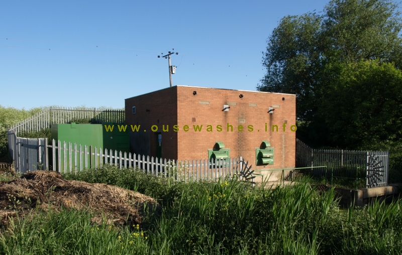 This pumping station (PS) is 1½ miles north of Welney at the head of Cross Drain, and pumps water from it up into the Old Bedford River (OBR) on the far side, thence
north-east, discharging by gravity into the Tidal River at Salters Lode via the Old Bedford Sluice (OBS).
This pumping station (PS) is 1½ miles north of Welney at the head of Cross Drain, and pumps water from it up into the Old Bedford River (OBR) on the far side, thence
north-east, discharging by gravity into the Tidal River at Salters Lode via the Old Bedford Sluice (OBS).Management
It is owned and operated by the local drainage authority, the Upwell Internal Drainage Board (IDB). Although independent, the IDB nevertheless receives considerable administrative and enginering assistance from the Middle Level Commissioners.Use menu to find link to details of management and staff
History
The station was built in 1975 and has little architectural interest. It was the first at this site and the two automatically controled diesel powered pumps have a total output capacity of 2.04 cumecs (m3/sec) to drain parts of the IDB's eastern area that could no longer be drained to the north or west as previously.The OBR has very little fall towards Salters Lode, and when the OBS is shut due to tide or siltation, the flow in the OBR can reverse and flow as far "upstream" as the PS at Welches Dam (WD). The role of the latter is to pump flood-water from the Cranbook Drain and two other IDBs out of the OBR into the Delph, and its capacity was designed just for that.
To avoid overloading WD PS, the Great Ouse River Authority (GORA), then managers of the Catchment, insisted that before this pumping station was built, Upwell IDB must pay to have a barrier constructed on the OBR upstream from here to prevent Upwell IDB's water being sucked-up to WD. The barrier is a single vertical sluice gate built about a hundred yards north of Welney Bridge, built in 1973 by GORA at Upwell's expense,
The station is a hundred yards or so north of where a wind drainage mill is shown on the first edition 1" OS maps of the 1820s, and named as Dixon's Mill on the old Tithe Map of 1836-1850. It became derelict many years ago and later demolished, although one or two courses of the base brickwork can still be seen.
The side view below gives some idea of the relative water levels. The Cross Drain which carries water to the station is well below the bottom of the metal fence and the Old Bedford/ Counterdrain (to the left of the grassy bank) was about level with the pumphouse roof when this photo was taken.
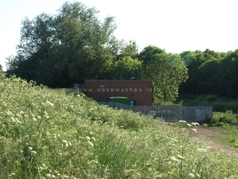
photos, above and below: Peter Cox, Jun 2010, Olympus E-410
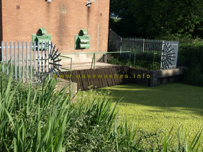
2010, a thick carpet of algae in front of the intake grill
Upwell IDB published a notice in the Cambs Times of 11th June 2010 advising that they "propose to install an automatic
weedscreen cleaner at Cock Fen PS near Tipps End, Cambridgeshire"
Well, they certainly need one here, but the address is for somewhere else.
Very strange.
Well, they certainly need one here, but the address is for somewhere else.
Very strange.
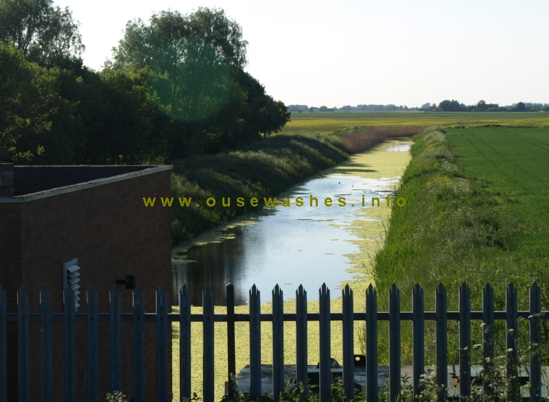
photo: Peter Cox, Jun 2010, Olympus E-410
looking north west along Cross Drain. A lot more algae on the way!
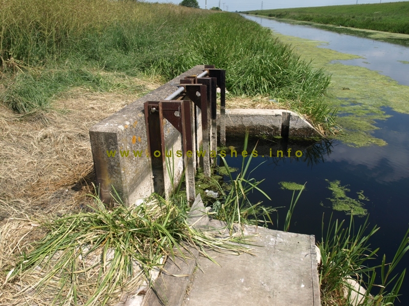
photo: Peter Cox, Jun 2010, Olympus E-410
The outfall into OBR seen in June 2010
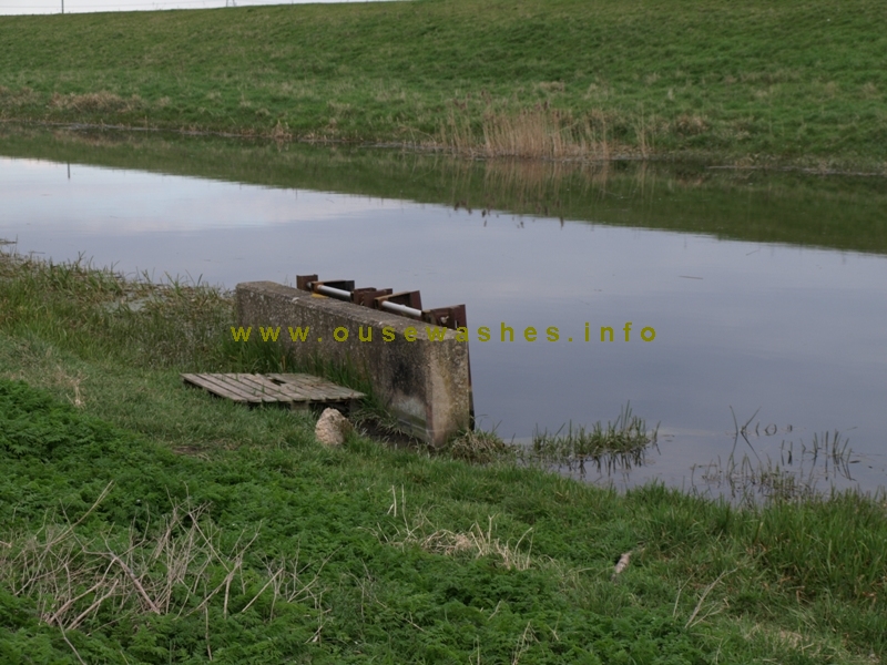
photo: Peter Cox, Mar 2011, Olympus E-410
The outfall seen in March 2011
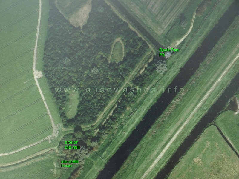
from Google maps, 2010
Satellite view displayed by Google in 2010 with my additions showing location of current pumping station and site of the old wind drainage mill (named on the old Tithe Map 1836-1850 as Dixon's Mill) taken from OS Maps.
Also another building just south of the mill thought to be Mill House, home of the mill-keeper and his family, with the track between them.
Moderisation of the power plant
Plans to convert to electric-powered motors
in 2021 the Board agreed to convert the station to electric power. That would need installation of 3-phase electricity supply, which UK Power Networks anticipated could be completed in March 2022. Installation of electric motors and panel could then be in May/June 2022.Due to unforeseeable legal issues concerning access to supply line route, plans were put on hold. Three years of discussions and negotiations with land-owners &/or occupiers did not resolve the matter.
In 2025 the MLC Chief Engineer, Nicola Oldfield, and the Consulting Engineer, Dave Bantoft, suggested the plan should be abandoned, partly due to the access issue but also the high cost of electricity. The Board accordingly resolved at an EOM in July 2025 not to proceed with conversion. It seems the station will remain diesel powered for another 10 years or so.
I'm confused about the electricity supply. From reports and IDB minutes, I thought the upgrade had not happened, yet the grid maps suggests the standard secondary distribution voltage of 11kV is in position (red lines) and visually I've seen newly installed poles along a good deal of the line. Further research needed.
The accounts for year ending March 2025 show over £6k spent on 'improvement works'.

Matters for attention with diesel motors
A report by Nicola Oldfield, MLC's Engineer, in Dec 2025 stated that the engines control panel is now 50 years old and should be replaced as it is corroded inside and cannot be deemed reliable. Cost is likely to be in the region of £20 to £30k.Also, consideration should be given to replacement of the engines.
Acknowledgements
Text and photos except where noted © Peter Cox, 2010-12
If you think there are any errors or ommissions on this page or would like to comment, please e-mail me and your response will be added.
If you think there are any errors or ommissions on this page or would like to comment, please e-mail me and your response will be added.
Page created Mar 2013, last edited: 05/01/26, 10:01